 877-857-9870
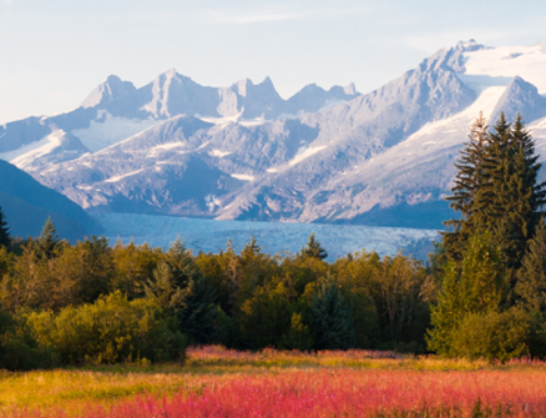
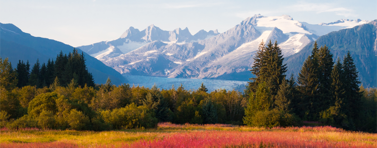
There are plenty of reasons to move to Anchorage, Alaska. Where else can you experience such incredible natural beauty in such close proximity to all the amenities of a mid-sized city like Anchorage?
And what better way to enjoy the stunning vistas in and around Anchorage than by taking a hike?
Get yourself outdoors with our below list of the 14 best hikes in the Anchorage area. They range from easy hikes for the entire family to tougher adventures for experienced hikers. Each offers its own compelling draw: beautiful views, wildlife encounters, waterfalls, lakes, and more.
If you’re ready to get out and explore all that Anchorage has to offer, this list will get you started.
Safety Tips for Hiking in Alaska
- Never hike alone. You’re safer with a buddy.
- Make sure someone knows where you’re going and when you expect to return.
- Weather can be unpredictable, so make sure you’ve got a few layers in your pack, in case the weather turns.
- There are plenty of bears in and around Anchorage. Make noise as you hike, including chatting with your buddy. Consider carrying bear spray.
- Pack plenty of snacks and water.
Flattop Mountain Trail
Distance: 3.3 miles
Difficulty: Challenging
Best For: Enjoying the views close to town
Hiking Flattop Mountain checks a lot of boxes: It will treat you to scenic vistas. The trailhead is close to downtown Anchorage, and there’s plenty of parking. As a result, Flattop is one of the most popular hikes in the area, especially during Anchorage’s long summer days.
Although this trail is frequently traversed, it does get quite steep at some points, which is why it’s marked challenging. If you want to try something a little easier, consider the Backside Flattop Trail, which starts from the Rabbit Creek Trailhead. At this same trailhead, you can also set out for a beautiful alpine lake. We’ll cover that option next.
Rabbit Lake Trail
Distance: 8.7 miles
Difficulty: Moderate
Best For: A stunning alpine payoff
This moderate hike offers beautiful mountain views the whole way, with a lovely payoff at the end: Rabbit Lake, picturesquely framed by North and South Suicide Peaks. Although their names seem a bit formidable, both can be summited, although some approaches are more challenging than others.
Parking for the Rabbit Lake hike can be a little tricky—and the winds can be strong on the way out—but the stunning view at the end makes it very much worth the trek.
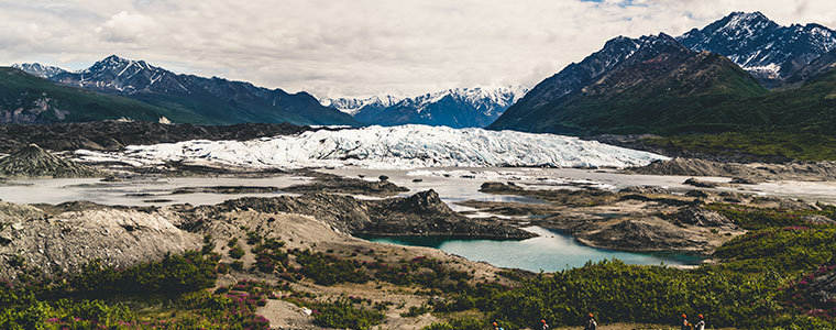
Byron Glacier Trail
Distance: 3.2 miles
Difficulty: Easy
Best For: Families and first-time glacier enthusiasts
If a close encounter with a glacier is on your bucket list, bookmark the Byron Glacier Trail. In addition to delivering excellent views of the glacier, it’s also a fairly easy trail that’s popular with families. Wear a good pair of shoes so you’re able to traverse the snow field toward the end.
Thunderbird Falls Trail
Distance: 1.8 miles
Difficulty: Easy
Best For: A quick-ish route to a waterfall
Some waterfalls really make you work for it. That’s not quite the case with the Thunderbird Falls Trail. After a short and fairly easy hike, you’ll arrive at the Thunderbird Falls viewing area, where you can take in the 200-foot cascade. Don’t let the trail’s initial incline discourage you. It gets significantly easier after that, but it can get muddy at times.
Kincaid Park
Within this 1,500-acre park, you’ll find hiking and walking trails, a motocross course, a disc golf course, and plenty of wildlife, including moose, black bear, and bald eagles. Our favorite trails in Kincaid Park include:
Tony Knowles Coastal Path
Distance: 19.7 miles
Difficulty: Easy
Best For: A picturesque stroll
Bikers, pedestrians, dog owners, and cross-country skiers all make good use of this long, meandering stroll. Along with beautiful coastal views, you can also soak in wildlife sightings, with birds, bears, and moose often spotted in the park. This paved trail rarely has much of a grade, so it’s perfect for those who simply want to enjoy a serene walk.
Andrew Lekisch Trail System
Distance: 3.1/4.6 miles
Difficulty: Moderate
Best For: A bit more of a challenge
During the winter, these trails are reserved for skiers. However, in the summer, these loops are available to pedestrians and dogs on leashes. The trail, named in memory of a promising local athlete who passed away at the young age of 15, offers a few more hills than the Tony Knowles Coastal Path. If you want to get your heart pumping, try the loops that make up this trail system.
Crow Pass Trail in Chugach State Park
Distance: 21 miles
Difficulty: Challenging
Best For: Choosing your own adventure
Although the Crow Pass Trail stretches for 21 miles total, you can still see plenty along the first few miles. In other words, feel free to make it an out-and-back hike of the length of your choosing. You’ll still be able to enjoy scenic mountain views, the remnants of old mining operations, and cascading waterfalls.
Or, if you’d prefer to turn it into an overnight adventure, you can take advantage of the campsites located at intervals along the trail. Finally, if sleeping on the ground isn’t your idea of a good time, you can also rent the Crow Pass Cabin, open from June–October.
O’Malley Peak Trail
Distance: 7.7–9.5 miles
Difficulty: Very Challenging
Best For: Experienced hikers looking for a challenge
Rock scrambles, scree, snow/ice, and mud, plus a 3,000-ft elevation gain all combine to make this one of the most challenging hikes in the Anchorage area. If you’ve got some miles under your belt, though, this might be the right challenge for you. Plus, you’ll have incredible mountain views to inspire you nearly throughout the trek.
Little O’Malley Peak Trail
Distance: 4.4 miles
Difficulty: Moderate
Best For: Hikers of all levels
Recent improvements have made it even easier to take in the Chugach Mountains and the city of Anchorage from the Little O’Malley Peak Trail. A number of switchbacks near the top of the hike also make the final ascent much easier for those with less hiking experience. In other words, if you want great views with a little more ease and accessibility, Little O’Malley is a great pick.
Those who want more of a challenge will find access to several other trails at the terminus of this trail, which starts at Glen Alps trailhead.
Rendezvous Peak Trail
Distance: 3.1 miles
Difficulty: Moderate
Best For: Getting some solitude
Mountain vistas for miles await you on the trail up to Rendezvous Peak. During the winter, the Arctic Valley Ski Area is a popular destination for those interested in winter sports. In the summer, the trails are open for hiking, including the Rendezvous Peak Trail.
In addition to the fantastic views, one of the real draws of Rendezvous Peak is the fact that these trails are less popular than some of the others on this list, so you’re likely to soak in a bit more solitude during your hike.
Bird Ridge Trail
Distance: 4.6 miles
Difficulty: Challenging
Best For: A good workout
For those who love a good aerobic workout with a side of excellent views, the Bird Ridge Trail is a great pick. If you can handle a 2,400-foot elevation gain in about a mile and a half, you’ll be rewarded with stunning views of Turnagain Arm from Bird Ridge Point. Bonus: If you’re hiking in the late summer/early fall, you might also get to snack on wild blueberries along the way.
Wolverine Peak Hike
Distance: 10 miles
Difficulty: Moderate
Best For: Stunning panoramic views
There are a couple of ways to get to Wolverine Peak, which delivers an incredible 360-degree view of O’Malley Peak, the Chugach Mountains, the Kenai Mountains, Mount Susnita, and the Talkeetna Mountains—among other sights.
One route starts at the Prospect Heights Trailhead, while the other starts at the Basher Trailhead. The Prospect Heights Trailhead adds about three-quarters of a mile, but the Basher Trailhead route can be a little harder to follow. Whichever you choose, you’ll be delighted by the payoff at the peak.
Winner Creek Trail
Distance: 5 miles
Difficulty: Easy
Best For: Easy hiking with great views
If you’ve got someone in your party in a wheelchair—or children in strollers—you can enjoy the first portion of the Winner Creek Trail together. Start behind the tram building at the Alyeska Resort, where this trail begins as a wide, accessible boardwalk.
If you continue on after the trail turns to packed dirt, you’ll reach Winner Creek Gorge, where water thunders through a small opening in solid rock. The famous hand tram out over Glacier Creek is currently closed. However, this hike is still notable for its excellent scenery—and its accessible initial section.
Campbell Tract Special Recreation Management Area
Distance: ~12 miles
Difficulty: Easy
Best For: A quiet walk with a side of history
Within the Campbell Tract Special Recreation Management Area, you’ll find 12 miles of biking and hiking trails, many of which are groomed in the winter for skiers. You’ll even find dog-mushing trails in the tract, which are reserved exclusively for these activities when there’s snow on the ground.
If you decide to take a stroll on one of the tract’s fairly flat and easy trails, you might catch sight of a moose, bear, bald eagle, or an owl, all of which make their home in the area. World War II buffs might be interested to know that some of the trails were originally created for tanks during this area’s time as Campbell Garrison, a satellite field to nearby Elmendorf Field.
Exploring Anchorage by Foot
What better way is there to get to know an area than by exploring it on your own two feet? This list of hikes only just scratches the surface of the many hikes, walks, and trails waiting for you in Anchorage. Each offers an at-your-own-pace look at a different aspect of the area’s natural wonders—a real perk to making your home in Anchorage.
Considering a permanent move to Anchorage? We’d be happy to help you make a move to the city—or anywhere in Alaska you’d like to live! Get in touch with our Anchorage-based team for a complimentary quote to get started.


